

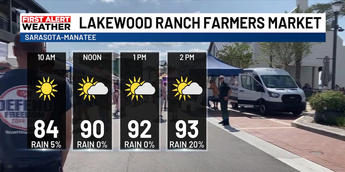
Fla. (WWSB) – It will be hot and humid Sunday and throughout the week, but that’s August on the Suncoast—nothing out of the ordinary. Sunday will feature scattered showers and thunderstorms developing in the afternoon and evening hours. Storms will be hit-and-miss, meaning not everyone will see rain today. Tuesday into next weekend looks much drier. Saharan dust and drier air move over Florida next week. This means lower rain chances and more consistent sunshine
Lakewood Ranch Farmer’s Market is located at Waterside Place, 1651 Lakefront Drive in Sarasota. This market runs from 10 AM to 2 PM. Today’s musical guest is Jake & Ariel (Acoustic Duo).
Local FIRST Tech Challenge robotics team, BotTanks, will be partnering with other STEM organizations to share different activities for school aged children to take part in. Stop by to enjoy a fun activity and engage with high school leaders to learn more about their passion!

The Wellen Park Farmers Market goes from 9 AM to 1 PM at 19745 Wellen Park Blvd in Venice.
The Coquina Beach Market is closed for now, scheduled to return October 1st! This market is located on the south side of Anna Maria Island. The Market is open on Wednesdays, Fridays and Sundays. Coquina Beach Market is an upscale beach market located at Coquina Beach on the south end of Anna Maria Island in Bradenton Beach.
Morning at the beach is looking great. Expect sunny skies with light southeast winds around 10 mph, shifting to the south in the afternoon. The water will be calm with minimal surf—just a foot or less. Rip current risk is low, so swimming conditions are safe. The main thing to watch for is a few afternoon showers and thunderstorms, so plan your beach time for the morning and early afternoon. It’ll be hot out there, so bring plenty of water and sunscreen
TROPICAL OUTLOOK – NEXT 7 DAYS
The National Hurricane Center is keeping an eye on two different tropical waves in the Atlantic this week — and while neither is an immediate threat right now, there’s potential for development as they move westward.
First System: Southwest of the Cabo Verde Islands:
There’s a broad area of showers and thunderstorms several hundred miles southwest of the Cabo Verde Islands. This tropical wave is moving westward across the central Atlantic, and there’s a chance it could gradually develop into something more organized early to mid-week. However, once it gets closer to the Lesser Antilles later in the week, upper-level winds are expected to become less favorable for development, which would likely limit any strengthening. Right now, there’s virtually no chance of development in the next 48 hours (near 0%), but by next week, there’s a low 20% chance it could become a tropical depression.
Second System: Coming Off Africa
Another tropical wave is expected to move off the west coast of Africa early this week. This one has better environmental conditions ahead of it. A tropical depression could actually form during the latter half of this week as it moves westward across the eastern and central Atlantic. Like the first system, there’s near 0% chance in the next 48 hours, but this one has a medium 40% chance of becoming a tropical depression by next week.
Copyright 2026 WWSB. All rights reserved.
